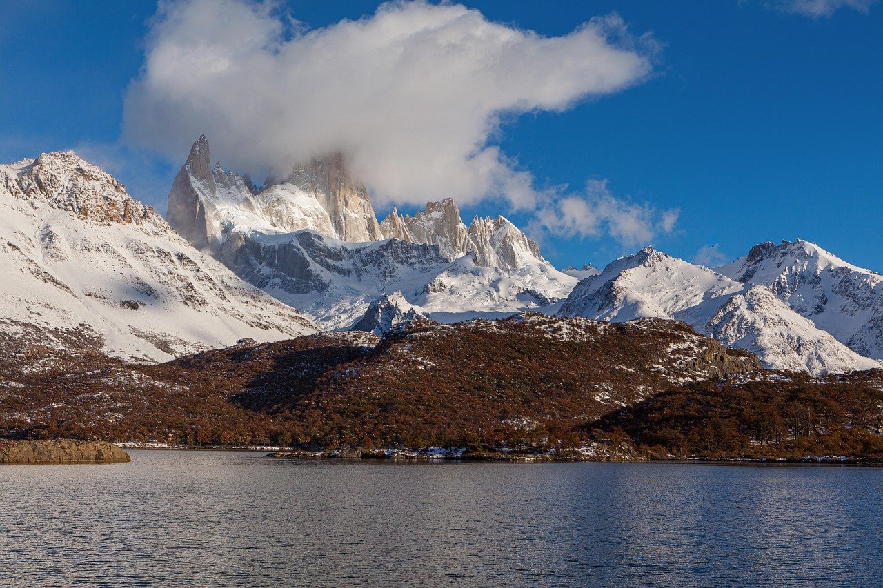
Mt. Fitz Roy 💎 Hidden Gem
The wind hits you first, a cold relentless gust that pours down from the Southern Patagonian Ice Field and bends the lenga beech trees into permanent gestures of surrender. Then you round a rocky shoulder and the granite spires of Mt. Fitz Roy appear: three thousand metres of pale orange rock stabbing through the clouds, rimed in glacial ice, impossibly vertical against an Antarctic-blue sky. Hikers fall silent at this moment, cameras forgotten for a beat, minds processing what the eyes are seeing. This is one of the most dramatic mountain landscapes on Earth.
History of Mt. Fitz Roy
The Tehuelche people who roamed these southern steppes long before European contact knew the mountain as Chalten, meaning smoking mountain, because of the clouds that perpetually swirl around its summit. That name lives on in the nearby trekking town of El Chalten, founded in 1985 partly to bolster Argentina territorial claim in a border dispute with Chile. The mountain Western name honours Robert FitzRoy, the British naval officer who captained HMS Beagle on the famous voyage carrying Charles Darwin. The mountain was named in FitzRoy honour by Argentine explorer Francisco Moreno in 1877.
The first confirmed ascent of the main summit (3,405 m) came in 1952, completed by French alpinists Lionel Terray and Guido Magnone. This achievement cemented Fitz Roy reputation as one of the world most technically challenging peaks. The sheer granite walls, prone to sudden storms and rime ice, still defeat far more expeditions than they allow to summit. Los Glaciares National Park, protecting the mountain and surrounding landscape, was established in 1937 and declared a UNESCO World Heritage Site in 1981.
What to See
The signature experience is the Laguna de los Tres hike, a 22-kilometre round trip from El Chalten that delivers hikers to a glacial lagoon at the foot of Fitz Roy east face. The final 400-metre scramble up a loose scree gully tests legs and lungs, but the reward is a turquoise lake studded with drifting icebergs and framed by granite walls so close you feel you could reach out and touch them. On clear days the reflection in the still water is almost surreal.
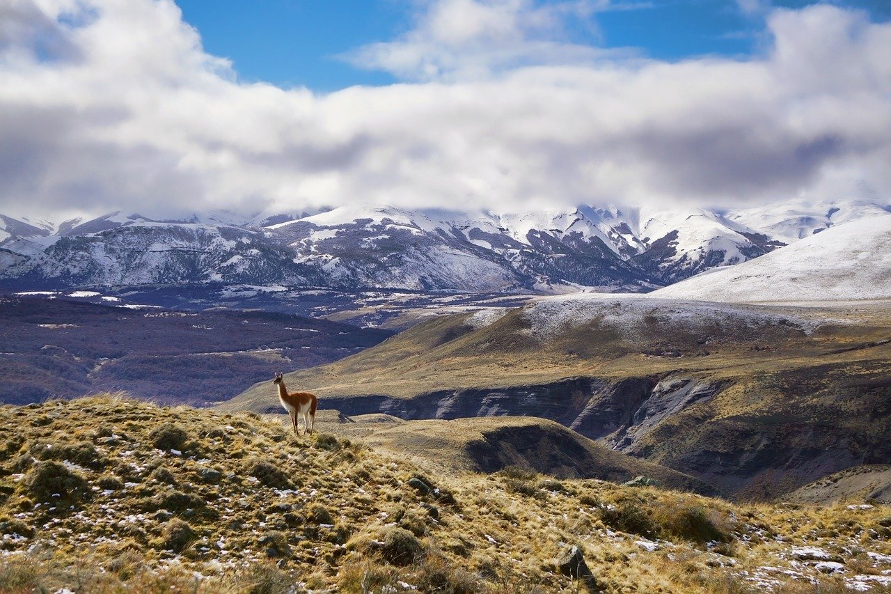
Beyond the signature hike, the greater El Chalten trail network offers multi-day routes to Laguna Torre beneath the needle-like Cerro Torre, the Rio Electrico valley, and remote campsites deep in the ice-field borderlands. Condors ride thermals overhead, Andean deer graze at treeline, and in spring the hillsides burst with scarlet firebush. Even a short walk from town to Mirador Capri rewards visitors with an early Fitz Roy reflection in still water, reachable in under two hours.
The Granite Spires
What makes Fitz Roy visually extraordinary is the geology: the massif is a laccolith, a body of magma that intruded into the crust roughly 12 million years ago and was slowly exposed by erosion of softer surrounding rock. The result is almost vertical granite, exceptionally hard and friction-rich, which is why Fitz Roy became a cathedral for rock climbers. The Supercanaleta route and other legendary lines on its walls draw elite alpinists from around the world to attempt fair-weather windows that can close within hours.
From a hiker perspective, the most dazzling aspect is how dramatically the mountain changes with the light. At dawn the east-facing slabs turn warm apricot-gold. At midday the rock is silver-white and stark. When clouds pour over the ice field and shred against the spires, the mountain becomes brooding and gothic. No two days ever look quite the same at Fitz Roy.
Practical Information
- Tickets: Park entry approximately ARS 45,000 (around USD 45) for international visitors; Argentine residents pay a lower rate
- Opening hours: Trails open year-round; El Chalten park ranger office 08:00-20:00 in high season (November-April)
- Best time to visit: November to March (Patagonian summer); December and January offer the longest daylight and warmest temperatures
- Duration: Laguna de los Tres day hike: 8-10 hours; multi-day circuits: 3-7 days
- Booking: Day hikes need no advance reservation; camping permits for Poincenot and De Agostini campsites are free and issued at the El Chalten park ranger office
Local Insights
What locals know that guidebooks do not always tell you:
- Start the Laguna de los Tres hike before 7 am to beat the crowds on the narrow scree gully and get the summit lagoon nearly to yourself for at least an hour.
- The Meteoblue weather forecast (free online) is far more accurate for El Chalten microclimates than general Patagonia weather apps.
- The Mirador de los Condores, a short detour off the main trail, is the best spot to see Andean condors soaring at eye level in the morning thermals.
- El Chalten has excellent craft breweries; arrive at La Cerveceria before 7 pm for its celebrated smoked lamb stew, the universally agreed post-hike meal.
- Wind gusts exceeding 80 km/h are common; rangers may close the upper scree section on bad days, so always build a rest day into your itinerary.
Getting There
- By air: Fly to El Calafate (FTE) via Buenos Aires (EZE); seasonal international connections available
- By bus: Daily buses from El Calafate to El Chalten, approximately 3 hours; operators include Cal-Tur and TAQSA
- By car: Drive Ruta 40 north from El Calafate (approximately 215 km); rental cars available in El Calafate
- On foot from town: Trailhead at the northern end of Avenida San Martin in El Chalten
Frequently asked questions
Do I need to pay to hike in Los Glaciares National Park?
Yes. International visitors pay a national park entry fee at the ranger station on the edge of El Chalten. Fees change annually; check the Argentine National Parks administration website for current rates.
Is the Laguna de los Tres hike suitable for beginners?
The trail covers 22 km round trip with 800 m of elevation gain, including a steep scree scramble near the top. It is accessible to fit hikers with no technical climbing experience, but is not recommended for young children or those with limited fitness. Trekking poles are strongly advised.
Are there toilets and facilities on the trail?
Composting toilets are available at the Poincenot and De Agostini campsites. No food or water is sold on the trail, so carry your own snacks and a water filter or purification tablets for stream water.
Can I fly a drone over Fitz Roy?
Drone use is prohibited inside Los Glaciares National Park without a special permit from the park administration. Violations carry significant fines. Ground-based photography is unrestricted.
What other hikes are close to El Chalten?
Laguna Torre (Cerro Torre viewpoint), Loma del Pliegue Tumbado panoramic ridge, Rio Electrico valley, and the multi-day Huemul Circuit are all accessible from town.