Motutapu Island
The ferry from Auckland’s downtown terminal pulls away from the city skyline, and within twenty minutes the urban noise fades to nothing. Motutapu Island rises from the Hauraki Gulf — rolling green hills tumbling to sheltered bays, native birds calling from regenerating forest, the whole scene unmarked by any development. This is one of the oldest land masses in the Gulf, 178 million years in the making, and one of the most ambitious conservation success stories in New Zealand: an island that has been systematically restored to ecological health through the dedication of thousands of volunteers, now beginning to sing again with the voices of birds that once fell silent.
History of Motutapu Island
Motutapu — meaning “sacred island” in Māori — has been inhabited for over 700 years. Archaeological surveys have identified more than 300 sites on the island, including pā (fortified settlements) built on strategic hilltops, storage pits for kūmara (sweet potato), and stone-working areas that speak to a sophisticated pre-European society. The island’s fertile soils and abundant fishing grounds made it a prized location, and it changed hands repeatedly through inter-tribal warfare in the centuries before European contact.
During World War II, Motutapu served as a key military installation in the defense of Auckland. The island housed barracks for thousands of soldiers, anti-aircraft gun emplacements, underground ammunition stores, and observation posts scanning the Hauraki Gulf for enemy vessels. Concrete fortifications from this era remain visible across the island, forming a layer of 20th-century history over the ancient Māori heritage. After the war, much of the island was used for sheep farming, which stripped the native bush. The transformation toward conservation began in the 1990s, when DoC launched what became one of the world’s largest island pest eradications, removing rats, mice, stoats, and other introduced predators to allow native species to return.
What to See
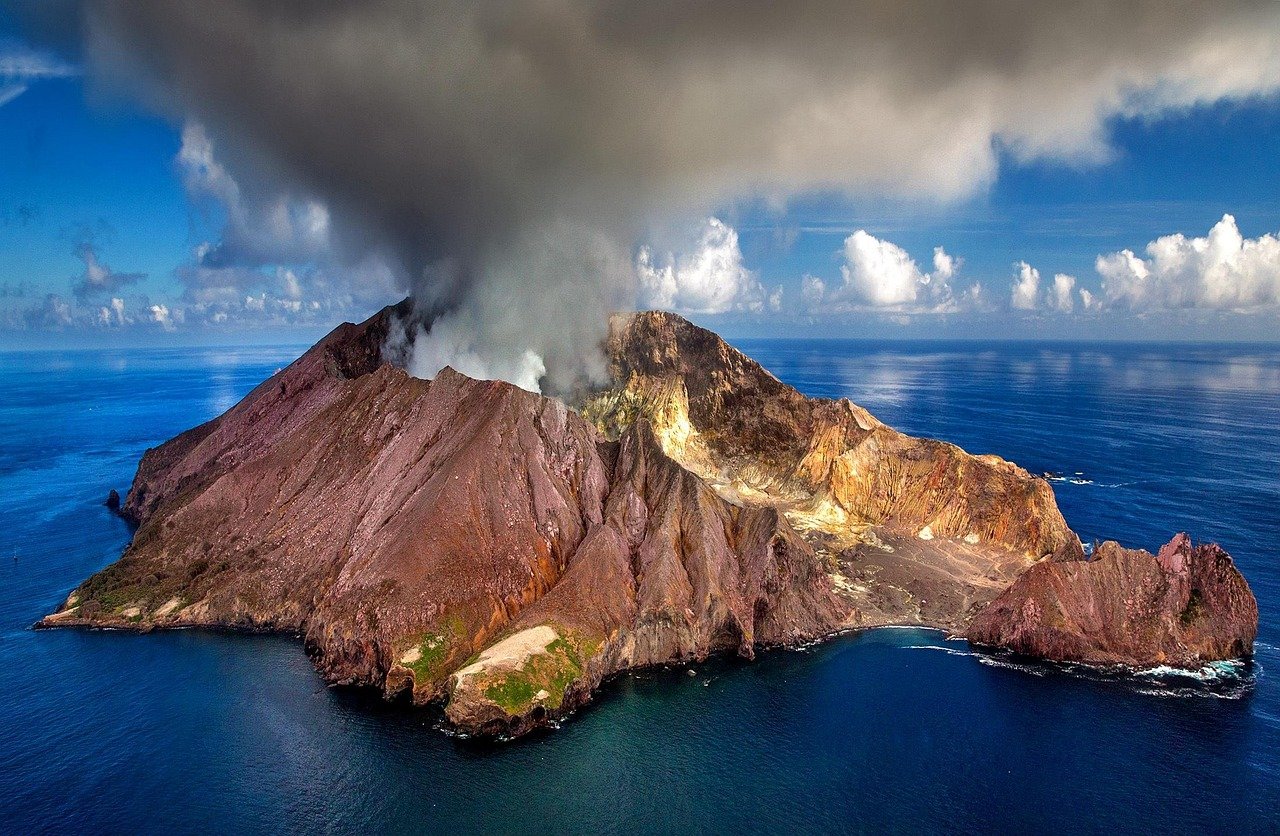
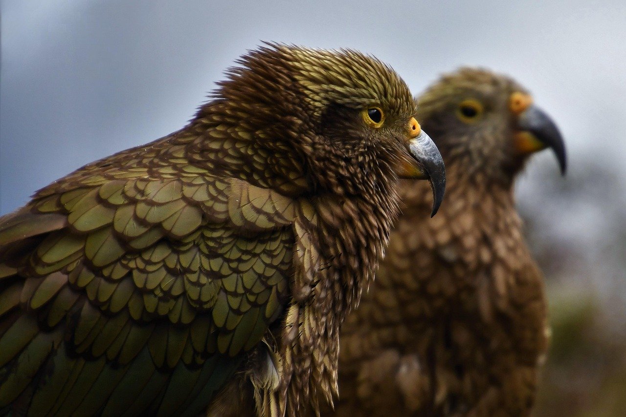
The Rotary Centennial Loop Track is the island’s main walking circuit — a two-hour loop through regenerating native forest planted by volunteers over decades. The forest is young but already alive with tui, fantail, and kākā, the native parrot that has returned to Motutapu as pest eradication has taken hold. The Motutapu Walkway connects the island to neighboring Rangitoto via a causeway, allowing an extended day of exploration across both islands — Rangitoto’s dramatic volcanic cone contrasting with Motutapu’s pastoral rolling landscape.
The island’s beaches — particularly at Home Bay — offer excellent swimming in sheltered, clean water. The remnant WWII fortifications at various hilltop locations provide both historical interest and panoramic views across the Gulf toward Auckland’s skyline, the Coromandel Peninsula, and the volcanic Rangitoto cone. Birdwatchers come specifically to look for the tīeke (North Island saddleback), a striking black bird with a chestnut saddle marking that was reintroduced to Motutapu after being absent for decades — its song, once common across New Zealand, is one of the most evocative sounds in conservation.
The Conservation Revival
Motutapu’s transformation is one of the most inspiring stories in global conservation. In 2011, a predator eradication operation removed rats, stoats, and other invasive species from the island’s 1,500 hectares — at the time one of the largest such operations ever undertaken. The result was immediate and dramatic: native plant regeneration accelerated, nesting success rates for seabirds improved dramatically, and species that had been locally extinct for generations were reintroduced. The tīeke (saddleback), pāteke (brown teal duck), and shore plover are all now breeding on Motutapu.
The volunteer-driven native planting program has seen over 600,000 native trees and shrubs planted across the island since the project began, transforming bare pastoral hillsides into thriving native bush. School groups, community organizations, and individual volunteers travel to Motutapu regularly to continue this work. Visiting the island is not just a recreational experience — it is an opportunity to witness, in real time, what New Zealand’s native ecosystems looked like before European settlement began their systematic destruction, and what they can become again with dedicated effort.
Practical Information
- Tickets: Ferry from Auckland’s downtown terminal with Fullers360; adult return approximately NZD 23–55 depending on route and season; no separate island admission fee
- Opening hours: Island accessible year-round; ferry schedules seasonal — more frequent in summer (Nov–Mar)
- Best time to visit: November to March for warmest swimming water; September–November for best birdwatching (breeding season active); avoid bringing soil or seeds from mainland
- Duration: Half day for a beach visit; full day to walk the loop track, explore WWII sites, and cross to Rangitoto
- Booking: Book ferries online at fullers.co.nz; DoC camping requires advance booking through the DOC website; no shops on island — bring all food and water
Local Insights
What locals know that guidebooks don’t always tell you:
- Motutapu has strict biosecurity rules — check your bags, shoes, and clothing carefully before boarding the ferry to ensure you’re not inadvertently carrying seeds, soil, or invertebrates that could undo decades of conservation work.
- There are no shops, cafes, or food facilities on the island — bring everything you need, including more water than you think you’ll need on the sunny, exposed hill tracks.
- The causeway walk between Motutapu and Rangitoto is one of Auckland’s most scenic — plan to cross it in both directions to see the Gulf views from each island’s perspective.
- Birdwatchers should bring binoculars and arrive early in the morning — native birds are most vocal and active in the two hours after dawn, particularly the tīeke whose song carries through the regenerating forest.
- Camping at Home Bay DoC campsite is one of Auckland’s most magical overnight experiences — falling asleep to the sound of the Gulf and waking to birdsong, with Auckland’s city lights reflected across the water at night.
Getting There
- Ferry: Fullers360 from Auckland Downtown Ferry Terminal to Rangitoto Wharf; then walk the causeway to Motutapu (~1 hour); seasonal direct services to Motutapu/Home Bay available in summer
- By kayak: Experienced sea kayakers paddle from the mainland; organized kayak tours also available from Auckland operators
- Private boat: Several marinas offer moorings; Home Bay has a public jetty
- Nearest terminal: Auckland Downtown Ferry Terminal, 99 Quay Street, Auckland CBD
Frequently asked questions
Do I need a permit to visit Motutapu Island?
No permit is required for day visits. However, camping on the island requires advance booking through the Department of Conservation (DOC) website as sites are limited. All visitors must comply with the island’s strict biosecurity rules: check clothing, bags, and footwear for seeds, soil, and invertebrates before departure from the mainland. The island’s pest-free status is critical to its conservation value.
Can I swim at Motutapu?
Yes — Home Bay and several other sheltered beaches offer excellent swimming in clean Gulf waters. Home Bay is the most accessible and popular swimming spot, a short walk from the ferry landing. The water is warmest from December through March. There are no lifeguards, so assess conditions before swimming and supervise children carefully.
What wildlife can I see on Motutapu?
Motutapu hosts a growing number of native New Zealand species, including tīeke (North Island saddleback), tūī, kererū (wood pigeon), pāteke (brown teal), fantail, and grey warbler. The surrounding waters have dolphins, and seabirds including shearwaters and petrels. The pest-free environment means nesting success is high, and the bird population grows each year. Birdwatchers consistently rate Motutapu as one of the best close-to-Auckland birding locations.
Is Motutapu connected to Rangitoto?
Yes — a short causeway connects the two islands, making a combined visit natural and popular. Rangitoto is a 600-year-old volcanic island with a distinctive cone shape and lava field environment that contrasts sharply with Motutapu’s pastoral and forested landscape. Many visitors ferry to Rangitoto, walk the summit track (1.5 hours return), cross the causeway to Motutapu, and ferry back from Home Bay — a full day circuit.
Are there facilities on Motutapu?
Facilities are minimal — a basic DOC campsite at Home Bay has toilets and water, and the Reid Homestead occasionally has limited food and drinks available. Beyond that, there are no shops, cafes, restaurants, or ATMs on the island. Bring all food, water, sun protection, and anything else you need for your visit. The island’s remoteness is part of its appeal — this is deliberately maintained as a natural reserve rather than a tourist facility.