Aconcagua Provincial Park
At 6,961 meters above sea level, Aconcagua is the highest peak in both the Western and Southern Hemispheres — a volcanic massif of ice and crumbling rock that looms over the Mendoza landscape with a physical authority that is difficult to comprehend until you are standing at its base. Even if you are not a mountaineer, the provincial park that surrounds it offers one of South America’s most dramatic encounters with high-altitude wilderness: condors riding thermals overhead, rivers running pale with glacial silt, and the Andes stretching in every direction toward the horizon.
History of Aconcagua Provincial Park
Aconcagua Provincial Park was established in 1983 by the Province of Mendoza to protect the ecosystems and archaeological heritage surrounding the mountain. Long before European contact, Aconcagua was known to the Inca and their predecessors, who conducted ritual ceremonies on its slopes. In 1985, archaeologists discovered an Inca mummy near the summit at 5,300 meters — a teenage boy buried approximately 500 years ago as part of the capacocha ritual sacrifice. The mummy, known as the “Child of the Andes,” is now displayed at the Museo de Ciencias Naturales e Históricas in Mendoza city.
The first recorded ascent of Aconcagua was completed in 1897 by Swiss guide Matthias Zurbriggen, climbing solo after his client Edward FitzGerald turned back at high altitude. Since then, the mountain has become one of the Seven Summits — the highest peaks on each continent — and draws thousands of climbers annually, ranging from technical mountaineers to hikers looking to reach base camp. The park now manages strict permit systems and waste regulations to protect one of the world’s highest and most fragile environments.
What to See
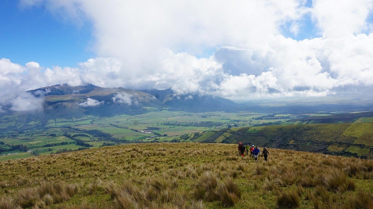
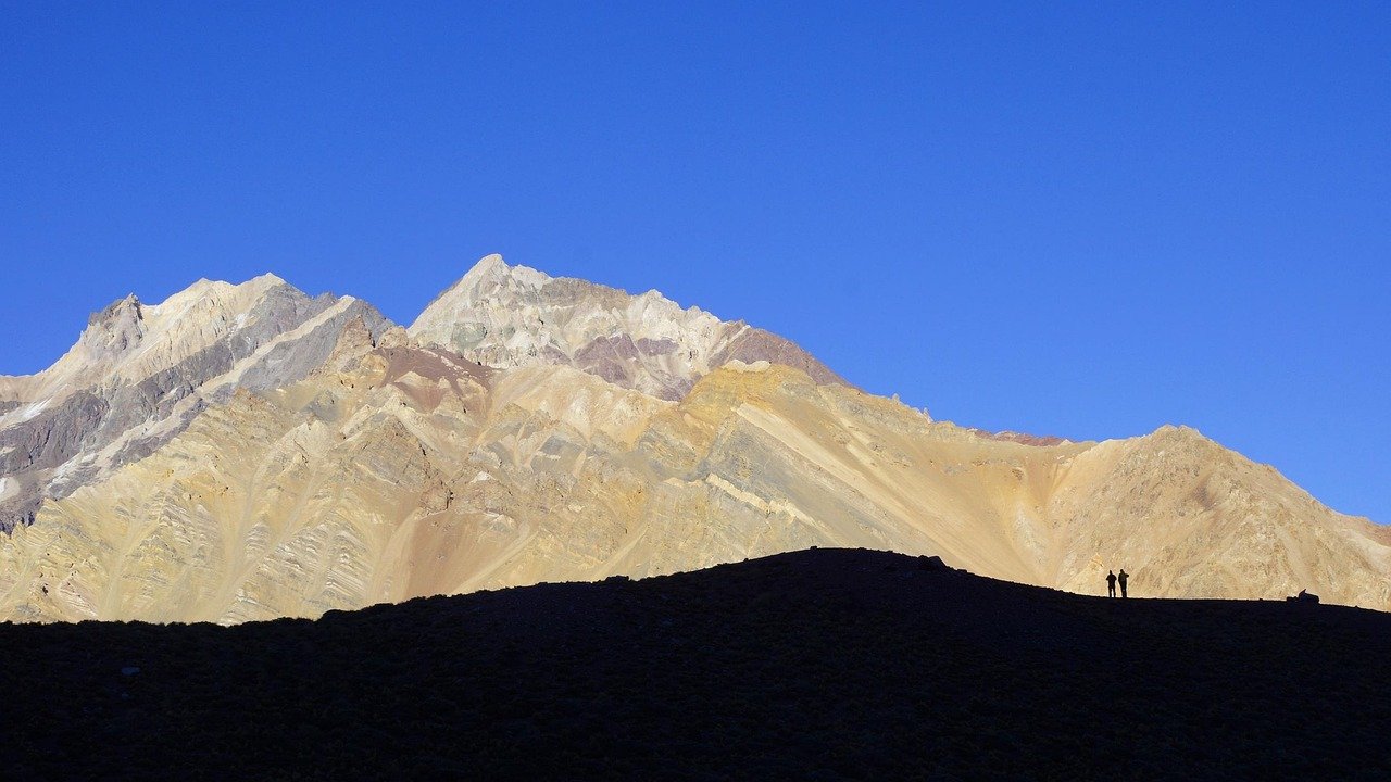
The park is divided into distinct zones offering very different experiences. The most accessible is the Horcones Valley approach: a well-marked trail from the park entrance at 2,950 meters leads 7 km to the Confluencia camp and on to Plaza Francia, a viewpoint at 4,200 meters with direct sight lines to the South Face of Aconcagua. This route requires no technical climbing and can be completed by fit hikers with appropriate acclimatization. The round trip to Confluencia takes about 6-8 hours from the entrance.
For climbers aiming for the summit, the Normal Route (Northwest Face) is the standard approach, passing through base camp at Plaza de Mulas (4,370 m), Camp Canada (5,050 m), and Camp Nido de Condores (5,570 m) before the final push. The Vacas Valley and Polish Glacier routes offer more technical alternatives. Even visitors who do not climb can experience the base camp environment: multi-day trekking packages bring non-climbers to Plaza de Mulas, where the views of the glaciated upper mountain are extraordinary.
The Mountain Environment

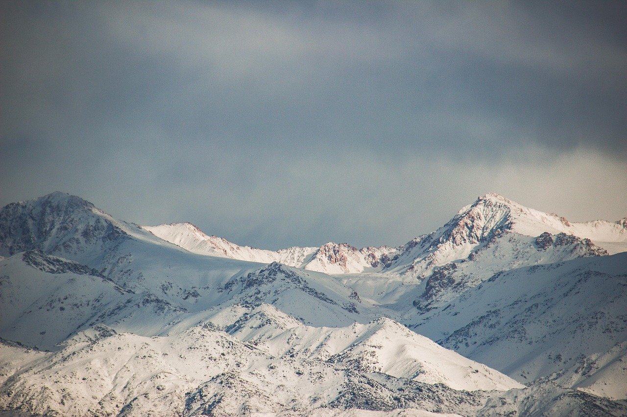
Aconcagua sits at the junction of three distinct ecological zones: the pre-Andean scrubland below 3,000 meters, the high-altitude puna grassland up to 4,500 meters, and the permanent snow and ice fields above. The lower zones support Andean condors — the world’s largest flying birds, with wingspans exceeding three meters — as well as guanacos, foxes, and numerous raptor species. Vicunas have been reintroduced to the valley floors and are now frequently sighted near the Horcones entrance.
The glacier system on and around Aconcagua is scientifically significant as one of the most closely monitored glacial complexes in the southern Andes. The Ventisquero Horcones Inferior, visible from the Plaza Francia viewpoint, has retreated substantially since the mid-20th century, providing researchers with one of the clearest records of Andean climate change. The park’s high-altitude research station at Plaza de Mulas supports ongoing studies of altitude physiology, atmospheric science, and glaciology.
Practical Information
- Tickets: Day-visit permit (Confluencia/Plaza Francia route): USD 30-50. Multi-day trekking permits from USD 130. Summit climbing permits: USD 760-1,200+ depending on season and route. Purchase at Mendoza Subsecretaria de Turismo or authorized agents.
- Opening hours: Park open year-round; main climbing season November-March. Day hikers can access during daylight hours.
- Best time to visit: December-February for the best weather on the mountain; March for post-season quiet and good conditions in the valley.
- Duration: Half day for the Horcones lagoon; 2 days for Confluencia; 8-20 days for a summit attempt depending on route and acclimatization schedule.
- Booking: Permits sell out — book months in advance for summit season. Online at the Mendoza provincial parks portal.
Local Insights
What locals know that guidebooks do not always tell you:
- Even day-trippers must have a park permit — rangers check at the entrance and no permit means no entry, regardless of how far you intend to walk.
- The Horcones lagoon, just 1 km from the entrance, is a stunning viewpoint accessible to anyone and gives a good impression of the landscape without requiring serious hiking fitness.
- Altitude sickness begins affecting visitors around 3,500 meters — acclimatize in Mendoza city or at lower elevations before tackling the longer trails in the park.
- The wind on Aconcagua is the primary challenge even for experienced mountaineers; whiteout storms can arrive with very little warning in all seasons, so check the park forecast before any excursion.
- The Los Penitentes ski resort, located just outside the park boundary on RN 7, offers a warm base and accommodation at 2,600 meters — a good starting point for day hikes into the park.
Getting There
- By car: Take Ruta Nacional 7 west from Mendoza city toward the Chilean border — the park entrance at Horcones is 183 km (about 2.5 hours). The road is paved all the way.
- Bus: Daily buses run from Mendoza central terminal to Puente del Inca (a few km from the park entrance); tell the driver you need the Aconcagua park stop.
- Organized tour: Most Mendoza operators offer day trips to the park entrance with a guide who handles permits — useful for first-time visitors.
- Taxi/Remis: From Mendoza city, a remis to the park entrance costs approximately USD 100-130 each way; confirm price in advance.
Frequently asked questions
Do I need a permit just to look at Aconcagua from the park entrance?
No — you can stop at the roadside viewpoints on RN 7 without a permit. But to enter the park and walk any trail, including the short path to the Horcones lagoon, a permit is required and must be purchased before arrival.
Is Aconcagua dangerous for non-climbers?
The lower valley trails (Horcones lagoon and the Confluencia route) are safe for fit hikers with proper clothing and awareness of altitude sickness symptoms. The upper mountain is serious high-altitude terrain requiring technical experience, proper equipment, and a full permit.
Can I see the summit from the park entrance?
On a clear day, yes — Aconcagua is visible from the park entrance and from the RN 7 highway. The best summit views from inside the park are from Plaza Francia (4,200 m) and from base camp at Plaza de Mulas (4,370 m).
What equipment do I need for a day hike in the park?
Sturdy hiking boots, layered warm clothing, windproof jacket, sunscreen (UV radiation is intense at altitude), sunglasses, plenty of water, and high-energy snacks. Even on warm days, temperatures can drop rapidly in the park valleys.
Are there guided tours of Aconcagua?
Many Mendoza tour operators offer guided treks to Confluencia and Plaza Francia. For summit attempts, hiring a certified mountain guide is not mandatory but strongly recommended; several reputable guide services operate out of Mendoza and from Plaza de Mulas base camp.